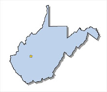
Answer: Many answers

·
Red: The Mason-Dixon Line
·
Purple: Maryland’s charter had claimed the area
north of Potomac River leaving the area below it to Virginia.
·
Orange: Virginia approved Kentucky County could
separate from Virginia and create their own state. This created the border
between Virginia and Kentucky.
·
Green: Virginia gave up land west of the Ohio
River. This included territories of Ohio, Indiana, and Illinois.
·
Blue: The western counties of Virginia that had
separated during the Civil War created the eastern boundary for the state.
- Yellow: Western border of Maryland
Get This Book Today


No comments:
Post a Comment